


Discover the Hidden Gem of the Lake Tahoe Area: The Potholes
A perfect blend of adventure and relaxation, look no further than The Potholes. This 1.5-mile out-and-back trail leads to a series swimming holes along the Silver Fork American River

Most visitors to the Lake Tahoe area have never even heard of this spot! But it’s an unforgettable blend of waterfalls, mini water slides, and a beautiful nature trail. If you’re new here, be sure to subscribe—my newsletter shares 5 handpicked trail recommendations each month and even more guides like this one.
PSA for all adventurers: This hidden gem is yet another pin on my California map, which includes filters for secret spots, waterfalls, and the best dog-friendly trails. It’s the best way to support my efforts to keep sharing epic spots like this.
Here’s everything you need to know for an unforgettable visit:
Swimming Spots
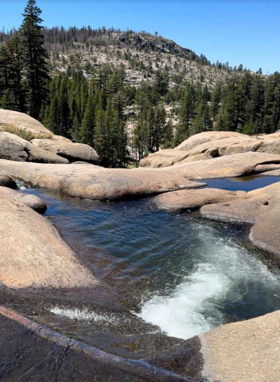
The Potholes are a series of naturally carved pools perfect for cooling off on a hot day. The water, clear and refreshing, ranges from shallow areas ideal for children to deeper pools suitable for jumping. I recommend an early arrival to avoid the summer crowds, especially on weekends. But even so, there’s plenty of space to find your own area to relax and swim.
Tips and Tricks
Arrive Early: The Potholes are popular, and parking can be limited. Arriving early ensures you get a good spot and a more tranquil experience.
Leave No Trace: Respect the natural beauty by packing out everything you bring. Stick to designated trails to minimize impact.
Safety First: The rocks around the pools can be slippery. Wear sturdy shoes and be cautious when navigating the area.
Picnic Ready: Bring a picnic lunch to enjoy by the riverside. There are no amenities along the trail, so come prepared with all necessities, including water and snacks.
Getting There
Driving Directions: From South Lake Tahoe, take Highway 50 West to CA-89. Turn right onto CA-88 after 11 miles. Drive on Carson Pass Highway (CA-88) for 19 miles until the entrance is on the right. Park just past the trailhead on the right side of the highway and then carefully backtrack towards the trailhead.
Use the AllTrails maps for directions to the trailhead.
The Trail
Trail Type: There-and-back
Distance: 1.6 miles
Elevation Gain: 140 ft
Difficulty: Easy
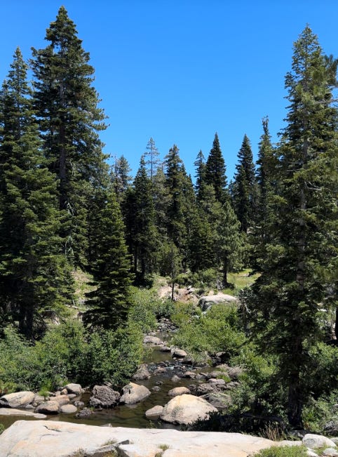
The hike begins near Silver Lake (the trail is well marked; look for an official trail sign and/or a rock that says “PH —>”) and follows a forest path. You can hug the river, but I suggest following the trail on the way out.
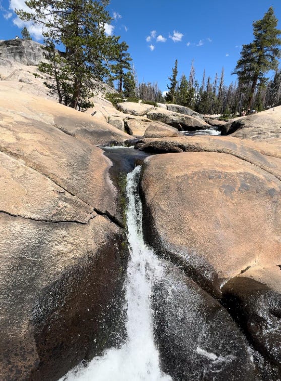
After about 3/4 of a mile, you’ll access a series of granite pools. I recommend crossing the river and then staying on the right-hand side if you are there to swim. There are numerous small waterfalls and swimming pools that are fun to explore. If you are looking for more adventure, stay on the left and head down the river about 3/4 of a mile to find the biggest waterfall and an extra secret spot.
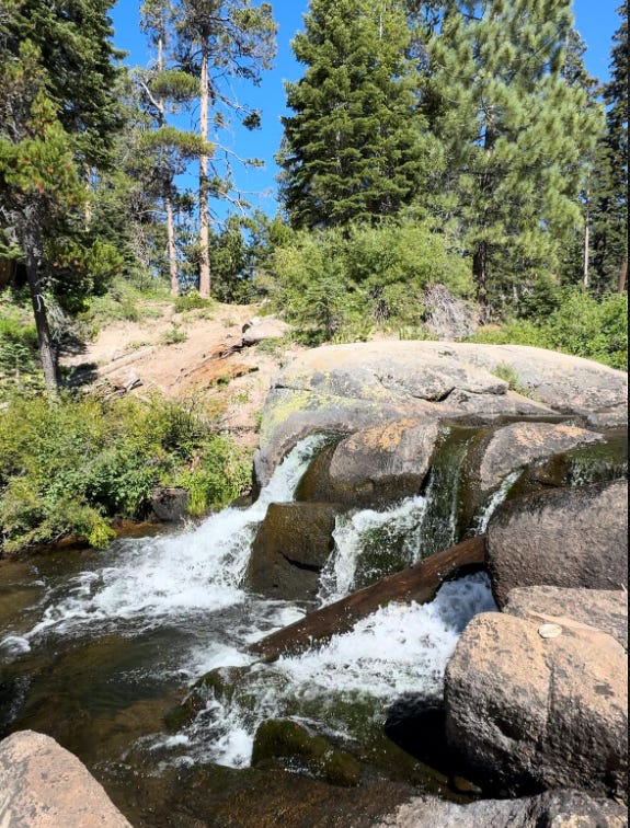
When you head back, go the same way you came except this time, stay closer to the river. If you do, you’ll find two bonus waterfall spots that are worth a photo!
Let me know what you think of this trail and if you want more guides like this!
-Dan
Hello, can you address the name of the trail head? Thank you. :)