


5 Bay Area Hikes for July
5 Bay Area Hikes for July
While it may be triple digits in some places, these five hikes will keep you cool and on the trails...


July is here, and the Bay Area trails are calling!
Before we jump into this month's trail recommendations, consider a premium subscription: benefits include prioritized spots in group hikes, exclusive secret spot reveals, and access to my comprehensive California map featuring hundreds of pinned locations that include my reels and AllTrails links.
Plus, if you sign up in July, and you'll receive free Outdoor Wise Living apparel!
Now, let's get to the trails:

1. Shark Fin Cove
Location: Davenport (near Santa Cruz)
Distance: 2.1 miles
Elevation Gain: 150 feet
Parking: Google Maps
Trail Guide: AllTrails Link
Shark Fin Cove offers a short but scenic hike along the coast near Santa Cruz. This easy trail leads you to a stunning beach with a unique rock formation resembling a shark fin. Perfect for a quick adventure or a sunset stroll, this spot is a hidden gem on the California coast. No dogs and a must do at low tide to reveal the sea cave!

2. Mount Davidson
Location: San Francisco
Distance: 1 mile
Elevation Gain: 250 feet
Parking: Google Maps
Trail Guide: AllTrails Link
Experience the highest natural point in San Francisco with an elevation of 928 when you go on a hike up Mount Davidson. This short but steep trail rewards you with panoramic views of the city and a peaceful, forested atmosphere. Don't miss the iconic 103-foot cross at the summit! Dogs welcome, but must be on a leash

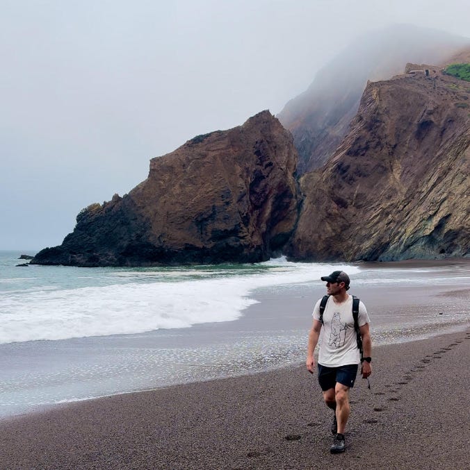
3. Pirates Cove
Location: Near Muir Beach
Distance: 3.8 miles
Elevation Gain: 900 feet
Parking: Google Maps
Trail Guide: AllTrails Link
Venture to Pirates Cove for a moderately challenging hike with spectacular coastal views. This trail near Muir Beach takes you through lush landscapes and ends at a secluded cove, perfect for a quiet picnic or exploration. The rugged beauty of this trail makes it a must-visit; it’s a scramble to get down to the beach (there’s a little sunken boat to be found down there best viewed at low tide). Dogs welcome, but must be on a leash.

4. Western States Trail
Location: Near Auburn
Distance: 2 miles
Elevation Gain: 150 feet
Parking: Google Maps
Trail Guide: AllTrails Link
An easy, dog, and kid friendly option. Here, you’ll actually be looking for the triple digits so you can cool off in the North Folk American River. You can either go out 1 mile to the waterfall and or stop at various access points for the river. My personal favorite spot to swim was below the No Hands Bridge - a pedestrian bridge that was built in 1912 to transport quarried rock. Watchout for jagged rocks if you want to dive in.
5. Tennessee Valley Trail
Location: Mill Valley
Distance: 3.4 miles
Elevation Gain: 344 feet
Parking: Google Maps
Trail Guide: AllTrails Link
The Tennessee Valley Trail is perfect for families and hikers of all levels. This gentle trail takes you through the scenic Marin Headlands to Tennessee Beach, a beautiful and often uncrowded beach. It's a great spot to enjoy the coastal scenery and relax by the water.
Thank you to all my paid subscribers—your support helps me bring you the best hiking content and keeps me exploring new trails. Remember to leave a comment if you're looking for a hiking buddy or have trail suggestions.
Think someone might enjoy this post you know? Refer a friend below!
Happy hiking!
Comment below if you’re looking to join a group hike, share your availability, or suggest a new trail. Don't forget to DM or email me with any questions!
So many hidden gems nearby makes hiking and discovery such an adventure